Running | Trailrunning

3-Länder Höhenweg

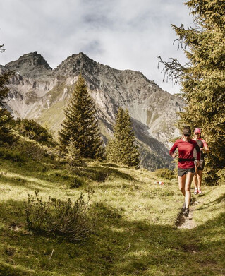
The start is at the Mutzkopf lift valley station and you first run up the Großmutzkopf and on to the Dreiländer Grenzstein, where Austria, Italy and Switzerland meet. You follow the mountain trail to the Rescher Alm, where you can eat for the first time. Flowing trails through the Rojental take you to Schöneben, where well over half is done. Via the fantastic last part of the mountain trail, with a constant view of Lake Reschen, the Ortler group and the Weißkugel, you finally reach the Haideralm, from where it only goes downhill to St. Valentin.
tour1
2424m
30.9km
Start point
Talstation Mutzkopflift
End point
Talstaion Haideralm

Similar Tours

Medium
776m | 16km
Running
Trailrun - Hohenzollernhaus
Begin: Parkplatz Wildmoos
End: Parkplatz Wildmoos
Medium
321m | 6.3km
Running
Trailrun - Faggenrunde
Begin: Fendler Straße
End: Faggenpromenade
Medium
1041m | 15.4km
Running
Trailrun - Platz-Gschnair
Begin: Tscheylücke Pfunds
End: Tscheylücke Pfunds
Difficult
1542m | 22.6km
Running
Trailrunning - Anton-Renk
Begin: Ried Kapuzinerkloster
End: Ried Kapuzinerkloster
Medium
690m | 12.6km
Running
Trail - Parcour - Mutzkopfrunde
Begin: Talstation Mutzkopflift
End: Talsta
Medium
381m | 7.5km
Running
Trailrun - Ochsenkopf
Begin: Fendels Sattelklause
End: Fendels Sattelklause
Easy
377m | 17.5km
Running
Trail Run - Rund um Pfunds
Begin: Infobüro Pfunds
End: Infobüro Pfunds
Easy
228m | 8.8km